Ruler Set for DeLorme® Atlas & Gazetteer All 50 States


Product Description
This ruler set was designed to be used with the DeLorme® Atlas & Gazetteers
The set contains 20 different rulers covering the map scales used by DeLorme®.
Each ruler carries a longitude scale calibrated for the southernmost latitude at which its map scale is used. Toward the north of that scale's coverage the atlas's longitude grid narrows a little, so tilt the ruler a few degrees to match — much less than the full grid angle the previous version of this set required.
The set also contains rulers for measuring statute miles and kilometers at each of the 20 map scales.
Some DeLorme® atlases also include city or regional maps at scales other than the main atlas scale. Rulers for these scale may not be included in this set.
The pages of the atlas have a printed lat/lon grid shown with thin black lines. The lines are marked with their (sku,version,type,description) VALUES just outside of the edges of the map, in a degrees, minutes and seconds format and in decimal degrees.
These rulers are somewhat different than our regular plastic rulers...
- They are printed on a 10 mil polyester stock. Waterproof, weatherproof, and tear proof, but a bit thinner than our stock rulers.
- They are 1.5 inches wide and 8.5 inches long.
We make these rulers using our custom ruler printing process. If you have need of a map ruler that not in one of our sets, check out the custom map ruler design page.
Add to Shopping Cart
Specifications
Scales:- 1:65,000 x 6 min.
- 1:77,000 x 7 min.
- 1:80,000 x 8 min.
- 1:84,000 x 8 min.
- 1:100,000 x 10 min.
- 1:135,000 x 13 min.
- 1:140,000 x 15 min.
- 1:150,000 x 15 min.
- 1:156,000 x 15 min.
- 1:160,000 x 15 min.
- 1:182,000 x 18 min.
- 1:200,000 x 20 min.
- 1:205,000 x 20 min.
- 1:225,000 x 24 min.
- 1:235,000 x 24 min.
- 1:250,000 x 25 min.
- 1:260,000 x 25 min.
- 1:300,000 x 30 min.
- 1:320,000 x 30 min.
- 1:400,000 x 40 min.
Height: 8.500 in. (216mm)
Width: 3.000 in. (76mm)
Thickness: 0.300 in. (8mm)
Made in US.
How to use products like this...
Measuring the lat/lon coordinates of a point on the map
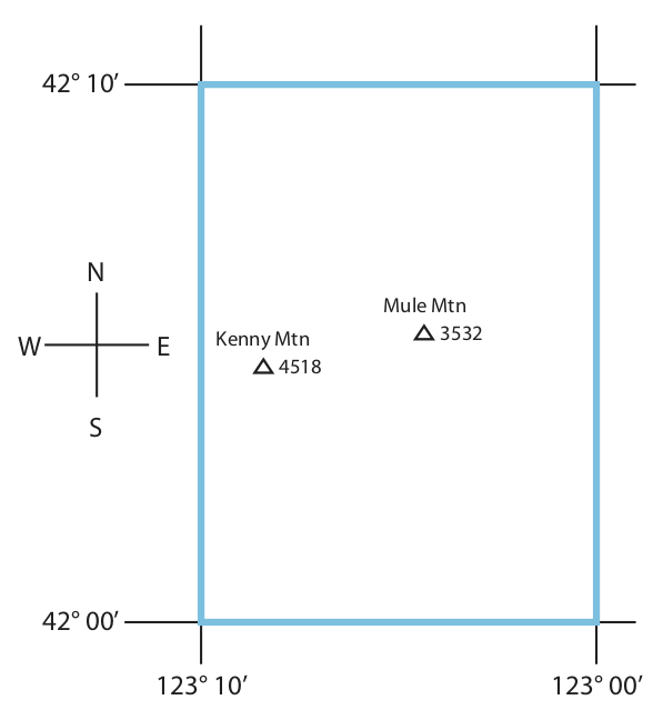
This example uses a 1:225,000 scale map with a 10 minute (10') latitude/longitude grid. It also also using a ruler marked in minutes and seconds. Your map may be a different scale and the grid size may be different. You will want to use a ruler that matches your map scale, is marked in the lot/lon coordinate format you want to use.
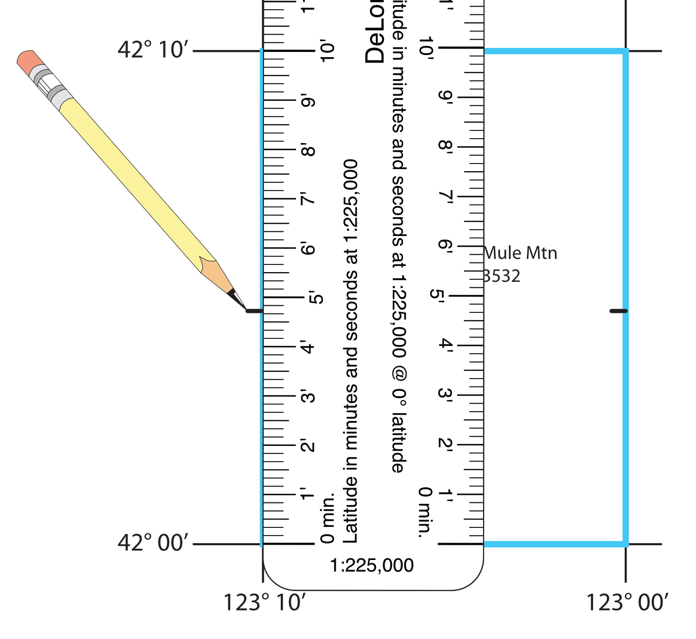
For this example we are going to measure the lat/lon coordinates for Mule Mtn.
Mule Mtn. is north of the N 42° 00’ grid line and west of the W 123° 00’ grid line. We’ll use our ruler to find out how much further north and west it is.
Use the ruler that matches the scale of your map.
Place the latitude scale, running north south, with the zero end on the 42° 00’ grid line, and the edge touching Mule Mtn.
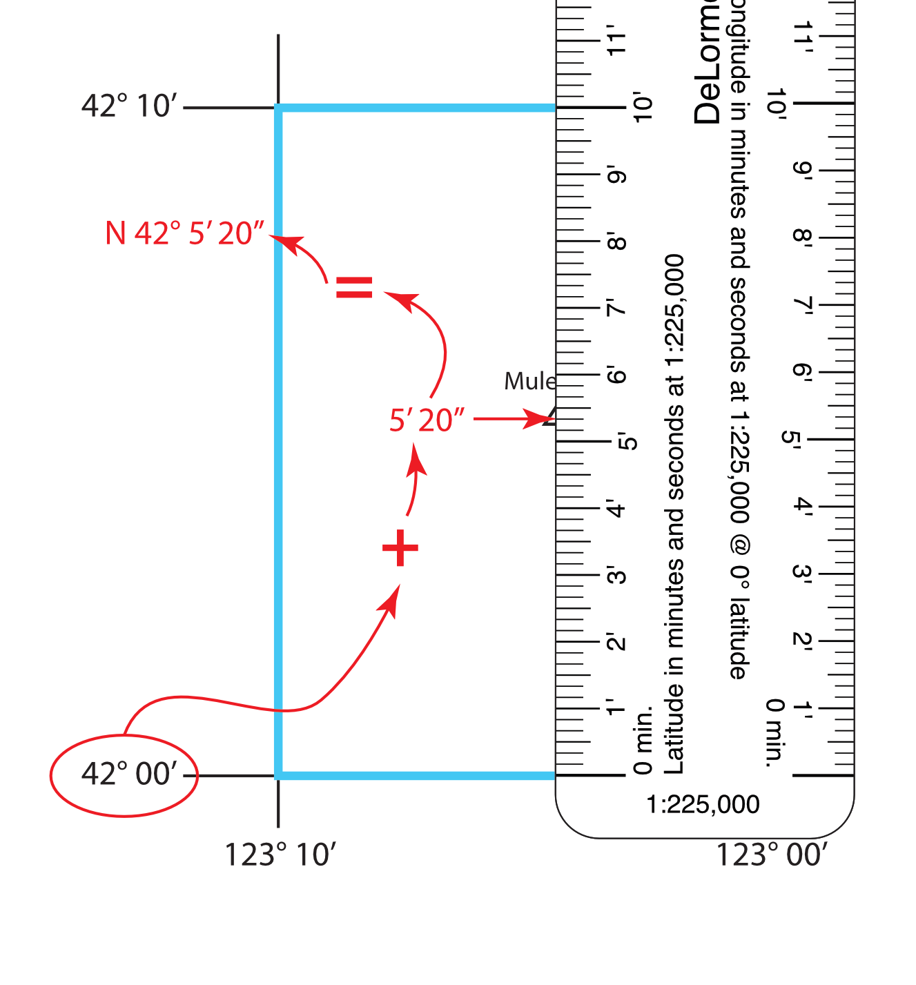
Mule Mtn. is 5’ 20” north of the southern grid line at N 42° 00’. So the latitude of Mule Mtn. is N 42° 05’ 20”.
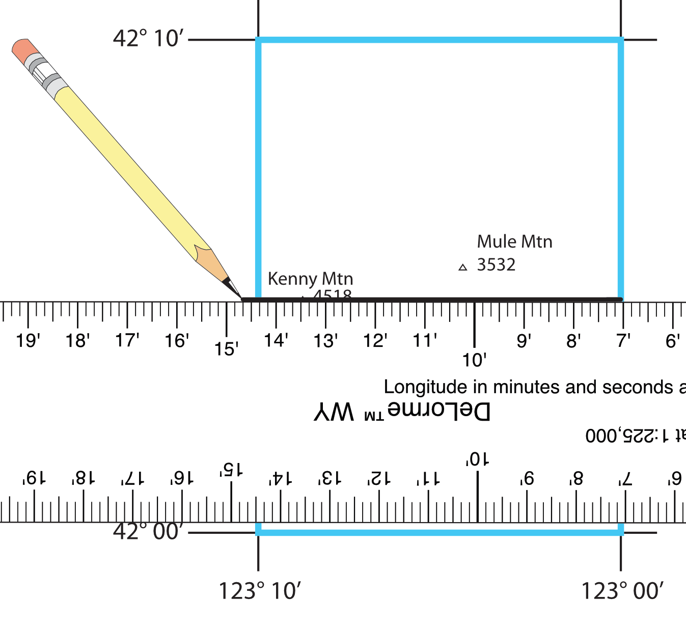
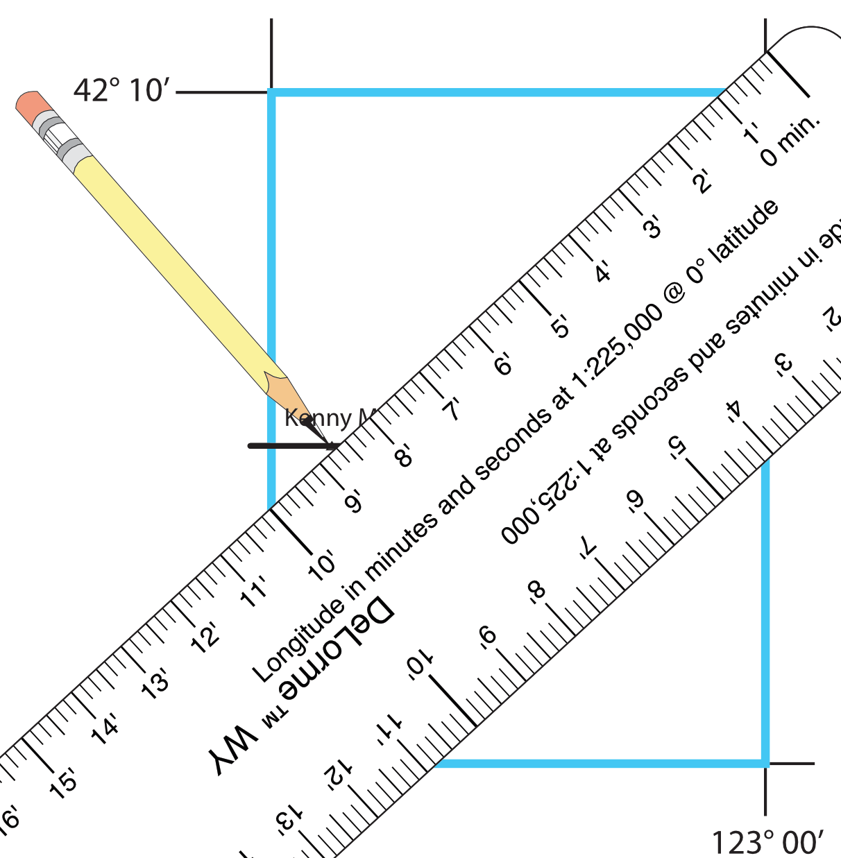
Place the longitude scale, with the zero end on the 123° 00’ grid line, the edge touching Mule Mtn, and the 10' mark on the 123° 10’ grid line. The ruler will need to be at an angle in order to fit within the 10’ grid. The angle from horizontal is approximately equal to the latitude, in this case about 42° The end of the ruler may need to extend past the 42° 00’ or 42° 10’ grid lines. You can angle the ruler in either direction.
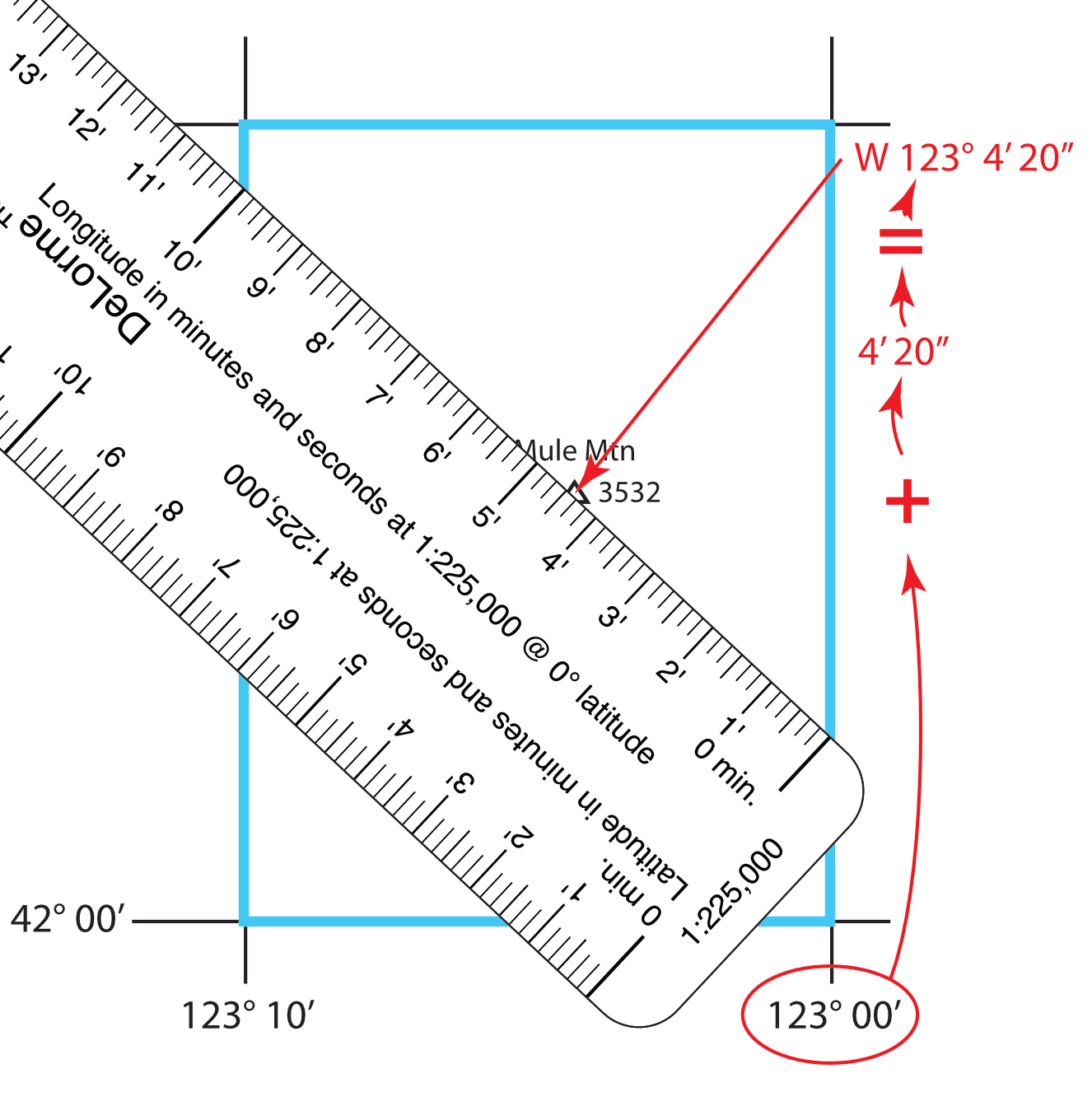
Mule Mtn. is 4’ 20” west of the eastern grid line at W 123° 00’. So the longitude of Mule Mtn. is W 123° 04’ 20”.
Plotting latitude longitude coordinates from your GPS
We’ll use the coordinates of N 42° 4’ 43” W 123° 8’ 25” for this example. Make sure your GPS receiver is set up to display coordinates in the HDDD°MM’ SS.SS” coordinate format, and that it is using a map datum that matches your map.
Select the ruler from the set that matches the scale of your map.
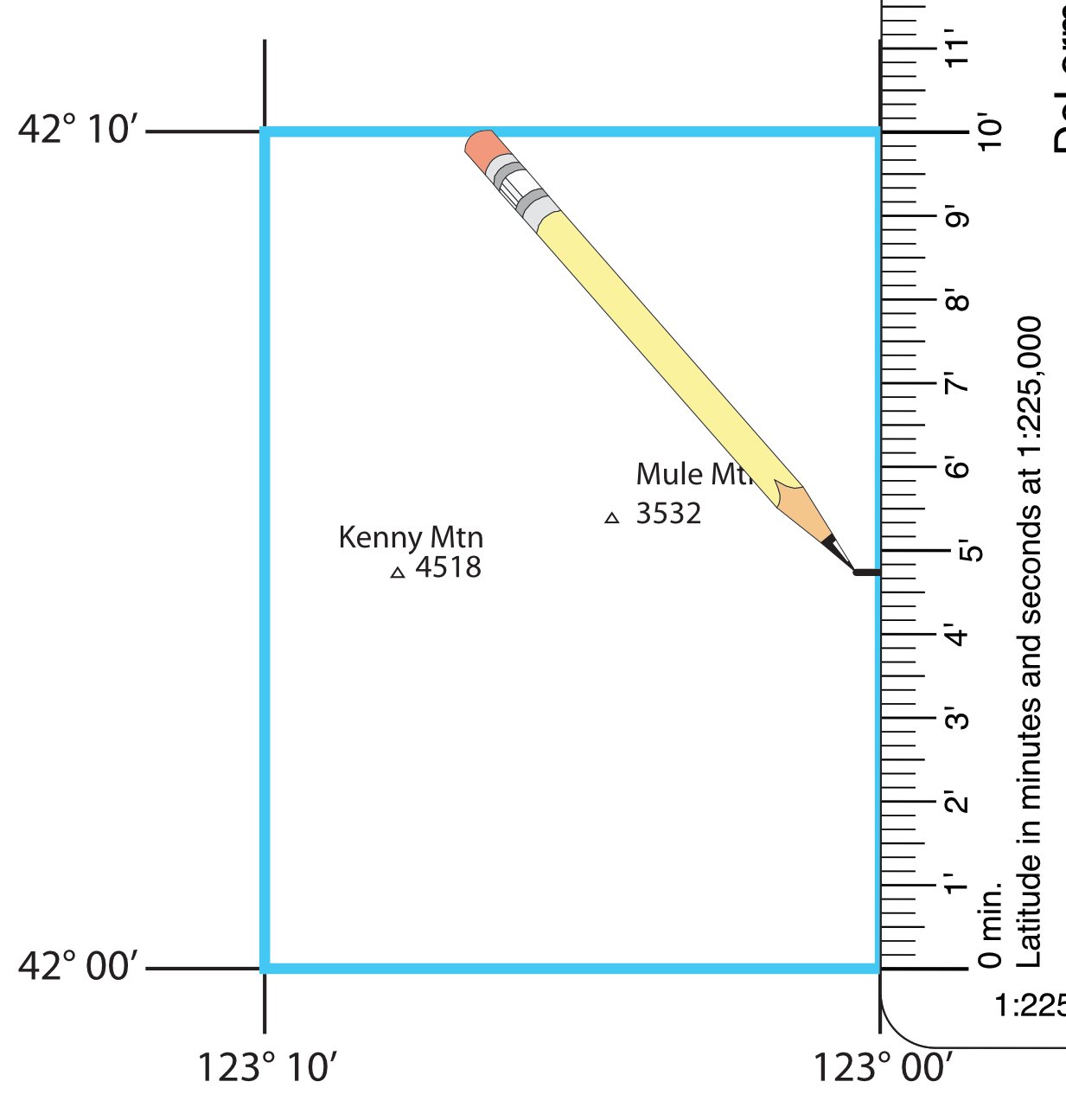
Use the latitude scale and a pencil to make small marks on both sides of the grid at the latitude you are plotting.
Draw a light line across the grid at the measured latitude.
Use the longitude scale. You will need to use it at an angle, so that the zero end and the marking for the grid spacing are on the edges of the grid. Using the ruler at an angle like this essentially "shrinks" it to fit in the grid.
Connecting the two latitude marks with a line will make it easier to figure out where the plotted longitude lies along the line representing the plotted latitude.
Slide the ruler up and down, until the desired longitude mark is on the latitude line you marked.
The angle for the ruler to fit will be approximately the same as the latitude. You may need to extend the edges of the grid line or place the ruler on the oposite diagonal to reach all points within the grid.
Here is a tutorial on working with latitude longitude coordinates.