1:100,000 Scale UTM Grid
For 1° X 2° USGS & BLM Maps
Note: Product edges and interior cutouts are shown with a thin red line.
Neither the red lines, colored background, nor map image are printed on the actual tool.
(more info)
Product Description
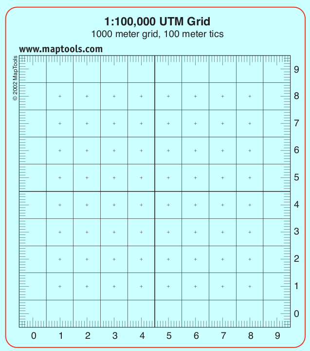
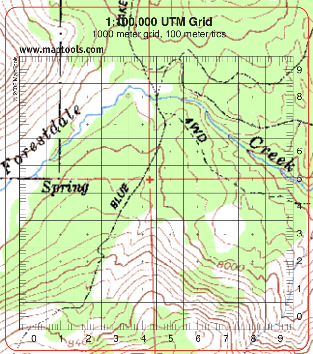
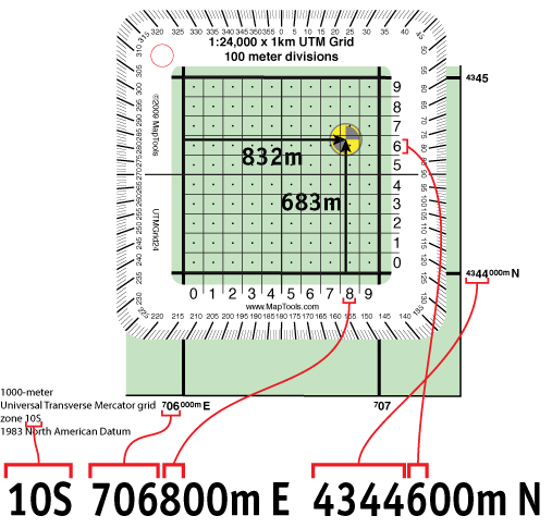
This easy to use grid tool divides a 10 kilometer grid square into 1 kilometer squares. Align the tool on the map grid and read off the easting and northing values. Additionally, by using a straight edge and the 100m tics along the edge, it is possible to locate a point with 100m precision.
The tool is about the thickness of a credit card, and the ink is coated to protect it from abrasion.
Add to Shopping Cart
| Item description | Quantity | Price | Quantity |
Specifications
Scales:- 1:100,000 x 10km
Height: 8.500 in. (216mm)
Width: 6.000 in. (152mm)
Thickness: 0.030 in. (1mm)
Made in United States.
Related Products
| Item description | Price |
|
UTM Grid -- Large Classroom Training Aid Part Id: UTMGrid-TA, Made in United States, UPC: 824249000757 |
$16.95 |
How to use products like this...
Using a grid style tool to plot/measure a UTM position with 100m precision
Here is a tutorial on using this type of tool.
Here is information on using the Universal Transverse Mercator coordinates (UTM).
Here is information on using the United States National Grid (USNG).
Here is information on using the Military Grid Reference System (MGRS).